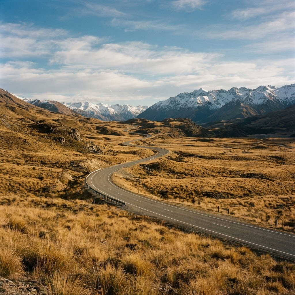
The Twizel to Queenstown Drive: What You Actually See Along the Way
The Twizel to Queenstown drive via Lindis Pass: 2h45m through high country, tussock basins, and glacier valleys. What actually unfolds on SH8.
The Twizel to Queenstown drive doesn't announce itself the way Milford Road does. There's no tunnel carved through granite, no fiord waiting at the end. What it offers instead is 195 kilometres of high country that shifts climate, geology, and colour temperature three times before you arrive—and a progression that makes more sense when you know what you're watching for.
Most people driving this route are coming off a Mount Cook detour or leaving a Mackenzie Country photography mission. They're pointed toward Queenstown with a tank of petrol and two hours forty-five minutes to fill. What actually unfolds between the two is worth understanding before you're halfway up Lindis Pass wondering why the entire landscape just changed colour.
Twizel to Omarama: The Mackenzie Basin Exit
You leave Twizel heading southwest on SH8, and for the first twenty minutes the landscape holds the same cyan-and-gold palette that defines the Mackenzie—turquoise canals, bleached tussock, and that high-altitude light that makes everything look like it's been colour-graded.
The road is straight and quick. You'll pass the Ohau snow fields turnoff at around the 12-kilometre mark—only worth noting if there's snow and you're curious about the access road that climbs toward the ski area. Most of the year it's just a gravel spur disappearing uphill.
Omarama appears at the 30-kilometre point, a service town with a bakery, petrol, and a gliding club that operates out of the airfield. If you're driving yourself and didn't fuel in Twizel, this is the last reliable stop until Cromwell. The town sits at the base of both the Lindis Pass route (which you're taking) and the Waitaki Valley route toward the coast (which you're not). The junction itself is unremarkable, but it's the geographic hinge between the Mackenzie and the Central Otago high country.
Lindis Pass: 971 Metres and a Climate Shift
Seventeen kilometres past Omarama, SH8 begins the climb to Lindis Pass. It's not steep—this isn't Crown Range—but it is steady, and the landscape starts shifting from Mackenzie blue-white to Otago gold-brown within the first few bends.
The pass tops out at 971 metres, and the summit is less a single point than a broad saddle of tussock basins that stretch east and west. This is high country in the purest sense: no trees, no lakes, just wind-shaped land forms and the kind of sky that makes you aware of weather systems.
What you're actually seeing here is the rainshadow effect made visible. The Lindis is east of the Southern Alps, far enough from the Main Divide that it receives a fraction of the precipitation. Tussock replaces beech forest. Gold replaces green. If you're driving this in summer, the contrast is stark. If you're driving in winter, it's all frost-white and brutal.
There's a rest area at the summit with a gravel pull-off and an interpretation board. Worth the stop if only to feel how much wind moves through here unobstructed.
The Lindis Valley: Descent Into Central Otago
The southern side of Lindis Pass drops into the Lindis Valley, and this is where the route becomes quietly cinematic. The road follows the Lindis River—a braided, boulder-filled waterway that cuts through tawny hills—and the valley widens as you descend.
You're now in Central Otago proper. The air is drier, the light is warmer, and the hills are rounded and treeless in a way that feels more like Andalusia than alpine New Zealand. If you've driven the West Coast or Fiordland first, this part of the South Island will feel geologically foreign.
The valley runs for about 35 kilometres, and the driving is gentle—long sightlines, wide curves, a river that braids and re-braids beside the road. In autumn, the willow and poplar shelter belts around the scattered stations turn gold. In spring, the hills go briefly green. In summer, it's all heat shimmer and tussock blond.
You'll pass Tarras at the valley's southern end—a small farming settlement with a salmon farm shop that's become an unlikely roadside fixture. If you need a break or a coffee, this is it. Otherwise, it's a blink-and-continue kind of place.
Cromwell Basin: Fruit Country and Hydro History
At Tarras, SH8 turns west and drops into the Cromwell Basin, and the landscape shifts again. The tussock gives way to orchards—stone fruit, cherries, apricots—irrigated and geometric against the brown hills.
You'll skirt the edge of Lake Dunstan, the long reservoir created by the Clyde Dam in the early 1990s. The lake is narrow and calm, and the road runs close to the shoreline for several kilometres. This stretch is fast and visual—water on one side, fruit trees and vines on the other.
Cromwell itself is the service hub for the basin—supermarkets, petrol, cafés that cater to the RV and rental car traffic. The town was partially flooded when the dam went in, and the old town centre now sits underwater. What remains is functional and modern, built around the highway junction where SH8 meets SH6.
If you're driving yourself and running low on fuel or time, Cromwell is the logical stop. If you're being driven from Twizel to Queenstown, your driver will choose whether to stop based on timing and whether you're interested in a fruit stall or a leg stretch.
The Kawarau Gorge: Final Descent
West of Cromwell, SH6 enters the Kawarau Gorge, and the route tightens. The road follows the Kawarau River through a steep-sided canyon of schist and scrub. This is bungy jump territory—the historic AJ Hackett Kawarau Bridge site is about 20 kilometres before Queenstown—and the gorge has a raw, adrenaline-tourism energy that contrasts with the quiet solitude of Lindis.
The gorge runs for about 30 kilometres, and the river is fast, green, and often full of jet boats. If you're driving in summer or during school holidays, this section can slow down—campervans, rental cars, and tour buses all bottleneck through here.
You emerge from the gorge into the Gibbston wine valley, and suddenly there are vineyards and cellar doors and the infrastructure of Queenstown's outer orbit. The mountains come into view—the Remarkables to the south, the Richardson Range to the west—and within ten minutes you're on Frankton Road, merging into Queenstown traffic.
Why the Drive Matters More When You're Not the One Driving It
The Twizel to Queenstown route works best when you can watch it rather than navigate it. The transitions—Mackenzie to Lindis to Otago to alpine—happen gradually, and if you're scanning for passing lanes or checking fuel range, you miss the sequence.
There's also the timing question. Drive this mid-afternoon in summer and you'll hit Kawarau Gorge at the worst possible hour, stuck behind a convoy of campervans while the light on the Lindis Valley fades in your rearview mirror. Drive it early or late, or let someone who knows the rhythm handle the wheel, and the route opens up.
LandFlight runs Twizel to Queenstown transfers in both directions, and the advantage is less about luxury than logistics—your driver knows when to leave, where the light works, and which rest stop makes sense for your schedule. You sit in the passenger seat and watch the high country do what it does.
If you're planning this leg after Mount Cook or before a Queenstown departure, it's worth asking whether you want to drive it yourself or arrive without the windscreen fatigue. Get a quote here and compare the numbers against a rental car day rate plus fuel. Often the maths is closer than you'd expect.
About the Author

James Whitfield
Senior Driver & South Island Route Specialist
James has driven every major South Island route for the past twelve years, specialising in alpine access and terrain logistics. He advises on winter transfers and lodge positioning across Canterbury and Otago.