The Dunedin to Queenstown Drive: What You Actually See Along the Way
The Dunedin to Queenstown drive takes 4 hours via SH6. Here's what you'll actually see: Cromwell orchards, Kawarau Gorge, and the road through Central Otago's tussock country.
The Dunedin to Queenstown drive covers 280 kilometres and takes four hours if you don't stop. You will stop. The question is whether you'll know what you're looking at when you do.
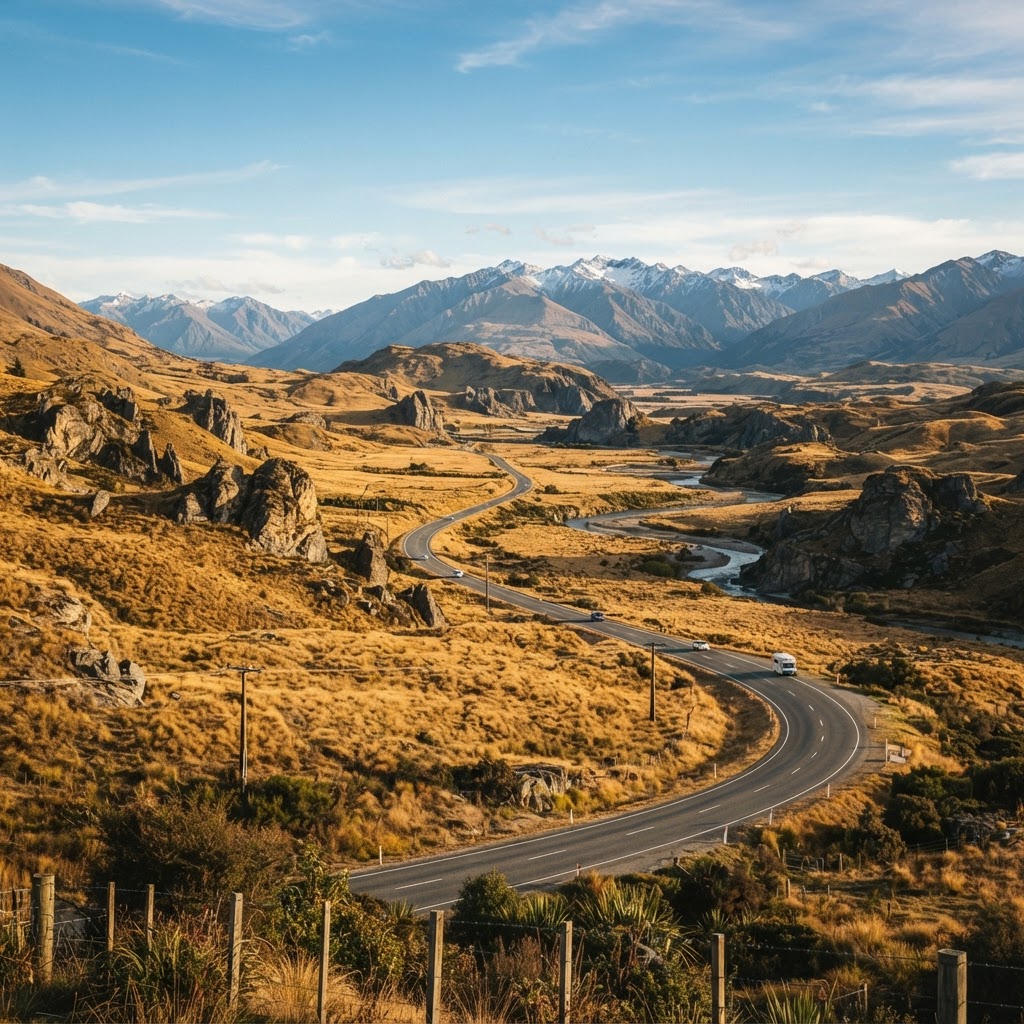
Most rental itineraries list this as a transit day—accommodation checkout in Dunedin's heritage precinct, dinner reservation in Queenstown, nothing remarkable in between. That assessment misreads Central Otago entirely. The interior country between the coasts doesn't announce itself like Fiordland or the Mackenzie. It earns its keep through accumulation: schist-ridge light, historic gold sluicings, the Kawarau River cutting through geological time in a canyon you'll drive beside for thirty minutes without cellphone reception.
This is what you'll actually see, in sequence, with the decision points that matter.
Dunedin to Middlemarch: The Taieri Plain
You leave Dunedin on SH87 through Mosgiel and onto the Taieri Plain—a broad alluvial stretch that reads as pastoral preamble. The plain runs due west with the Silver Peaks range to your north. At Outram, 30 kilometres out, the Taieri River crosses under the road. This is spring-fed Canterbury-style country: dairy, some cropping, hedge shelter belts.
The plain lifts gently toward Middlemarch (54km from Dunedin), where SH87 meets the Otago Central Rail Trail terminus. Middlemarch serves as the eastern anchor for the rail trail, and you'll see cycle tourers and shuttle vans staging here. The town itself is functional—petrol, basic supplies, a pub. It's the last flat ground you'll see for two hours.
From Middlemarch, you have a choice: continue west on SH87 through the Maniototo to Cromwell, or cut southwest on Serpentine Road toward SH6. Most GPS routing defaults to SH87. It's faster by twenty minutes and avoids a gravel section, but you pay for that efficiency with an hour of featureless high country.
The Serpentine Alternative: Rough River and the Raggedy Range
Serpentine Road is partly sealed, partly maintained gravel. It drops through the Rough River valley with the Raggedy Range to the south—a line of tussock summits that caught afternoon gold-rush traffic in the 1860s. The road is narrow, occasionally corrugated, and reduces your average speed to 60kph. Rental companies discourage it. If your vehicle is insured for gravel and you're comfortable with thin roads, it's the more textured option.
The Serpentine route rejoins SH6 near Luggate, saving you the Maniototo plateau crossing. You lose time but gain landform variety. It's a question of what you value: efficiency or geography.
SH87 via the Maniototo: Plateau Country
If you stay on SH87, you climb out of the Taieri basin onto the Maniototo Plain—a 600-metre-high tussock plateau that stretches from the Rock and Pillar Range east to the Hawkdun Range west. This is Central Otago's bare interior: sparse rainfall, continental temperature swings, towns spaced 40 kilometres apart.
Ranfurly (114km from Dunedin) is the Maniototo's service centre. Art Deco commercial buildings, a famous pie shop, Rail Trail bike hire. The plateau light here is exceptional—thin air, long sightlines, the kind of clarity that makes distance deceptive.
West of Ranfurly, SH87 crosses Danseys Pass Road (turnoff to the north, unsealed, not relevant to this route) and continues through Lauder and Omakau. The landscape holds: tussock, schist outcrops, merino stations running to the horizon. It's meditative if you're comfortable with space, monotonous if you're not.
At Omakau, SH87 meets SH85 (the Pigroot). Turn south. In 18 kilometres you'll reach Cromwell.
Cromwell: The Midpoint Decision
Cromwell sits at the confluence of the Kawarau and Clutha rivers, 160 kilometres from Dunedin and 120 from Queenstown. The town was partly submerged in 1993 when the Clyde Dam created Lake Dunstan upstream. What remains is a stone-fruit hub—apricots, cherries, peaches—with roadside stalls operating November through March.
This is the route's natural midpoint. There's good coffee (Grain & Seed), lunch options (Barker's of Geraldine café, Armando's), and clean amenities. If you left Dunedin at 9am without stops, you'll arrive in Cromwell around 11:30am.
From here, SH6 turns west and enters the Kawarau Gorge.
Kawarau Gorge: The Scenic Substance
The final 100 kilometres from Cromwell to Queenstown are why people remember this drive. SH6 follows the Kawarau River downstream through a schist canyon lined with thyme and wild rose. The river is swift, blue-green from glacial silt, and historically significant—this was the 1860s arterial route to the Wakatipu goldfields.
Bannockburn appears 10 kilometres west of Cromwell, a spur valley to the south known for pinot noir. The road narrows. You'll pass the Roaring Meg power station and the Nevis Bluff, a 100-metre schist cliff face that closes the gorge on the northern side.
At Gibbston, 45 kilometres from Queenstown, the valley opens slightly. This is the start of the Gibbston wine sub-region—cellar doors line the road (Peregrine, Chard Farm, Gibbston Valley Wines). The AJ Hackett Kawarau Bridge bungy site is here, marked by the original 1988 jump platform over the river.
Beyond Gibbston, the gorge tightens again. The road clings to the northern bank, cut into schist, with the river directly below. There are no settlements, minimal turnouts, and almost no cellphone signal for 25 kilometres. The Shotover River confluence appears 20 kilometres from Queenstown, and the landscape begins its transition to the Wakatipu basin.
Arrival: Frankton and the Wakatipu Basin
SH6 bypasses central Queenstown via Frankton—the industrial and airport suburb at the eastern end of Lake Wakatipu. If your accommodation is in Queenstown's town centre, you'll turn south onto Frankton Road and follow the lakeshore for 8 kilometres. If you're continuing to Glenorchy, Arrowtown, or Wanaka, you stay on SH6.
The basin light is different from the interior—damper, more temperate, framed by the Remarkables to the east and the Richardson Range west. The transition is abrupt.
The Return Angle: Queenstown to Dunedin
The same route in reverse front-loads the scenic substance. You leave Queenstown, spend the first hour in the Kawarau Gorge, reach Cromwell by mid-morning, and face the Maniototo plateau as the day flattens. Afternoon light on the Rock and Pillars is excellent if the weather holds. Dunedin arrival typically coincides with commuter traffic if you're on a standard checkout schedule.
From a logistics perspective, the return direction suits early departures better. If you're picking up clients from Queenstown accommodation at 8am, you'll clear the gorge in good light and reach Dunedin by early afternoon—enough time for an evening flight south or onward coastal routing.
Who Should Drive, Who Shouldn't
This is a straightforward drive by South Island standards—sealed highways, predictable gradients, well-signed. Rental cars handle it without issue if you avoid the Serpentine gravel section.
The trade-off is attention. Four hours is long enough that fatigue becomes a factor, especially if you've come off a Milford day or a late Queenstown arrival. The Kawarau Gorge section has no margin—narrow lanes, rock fall zones, international drivers unfamiliar with New Zealand's passing protocols. It's not dangerous, but it's not passive.
For travellers moving between high-end stays—Roslyn apartments in Dunedin to Matakauri or Azur in Queenstown—the Dunedin to Queenstown private transfer makes routing sense. You see the same country from the same seat without the cognitive load. The driver will stop at Cromwell, point out the Nevis, and time the gorge for light. You'll arrive without the low-grade fatigue that comes from four hours of concentration on an unfamiliar road.
The landscape delivers either way. The question is whether you want to be watching it or managing it.
Marcus Reid is based in Queenstown and has driven every permutation of Central Otago's highway network over fifteen years of guiding and logistics work. He writes about South Island routes with particular attention to return-leg economics and terrain. For a no-obligation quote on the Queenstown to Dunedin route or other South Island transfers, visit our quote page.
About the Author

Marcus Reid
Queenstown & Fiordland Route Driver
Marcus has driven every permutation of Central Otago's highway network over fifteen years guiding and logistics work. He writes about South Island routes with particular attention to return-leg economics and terrain.